BALI GEOGRAPHY
Among 17,500 islands across the Indonesian archipelago, Bali is one of the 33 provinces of the Republic of Indonesia.
The largest archipelagic country in the world, made up of 2,000,000 km2 of land with a chain of islands stretching over 500,000 km from Sumatra to Papua, and covers territorial waters of more than 5,000,000 km2.
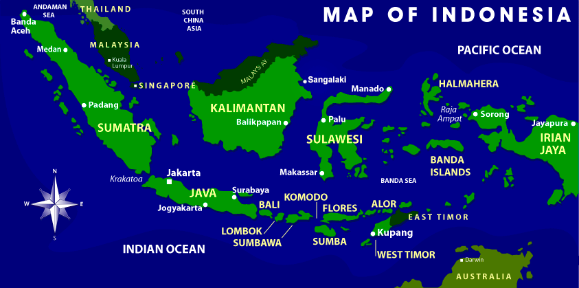
Situated between Java and Lombok, the island of Bali is located 8 to 9 degrees south of the equator with the Java Sea to the north, the Indian Ocean to the south.
Bali’s covers an area of 5,636 km2 or 0.29% of Indonesia, measuring just 90km long the north-south axis and less than about 140km from west to east.
Divided into three areas of water, the North Bali Sea is about 3,168km2, the East about 3.350km2, and the West about 2,982km2.
Bali Sea covers an area of 9,500km2. The North Bali sea runs along the coastline of Buleleng, the East Bali Sea runs along the coastline of Karangasem.
Klungkung and Gianyar, and the West Bali Sea include the coastline of Badung Tabanan and Jembrana.
The island of Bali lies 3.2 km (2.0 mi) east of Java, and is approximately 8 degrees south of the equator. Bali and Java are separated by the Bali Strait.
East to west, the island is approximately 153 km (95 mi) wide and spans approximately 112 km (70 mi) north to south; administratively it covers 5,780 km2 (2,230 sq mi).
Or 5,577 km2 (2,153 sq mi) without Nusa Penida District, its population density is roughly 750 people/km2 (1,900 people/sq mi).
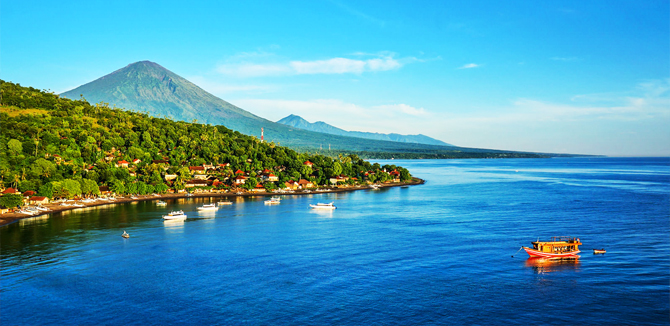
Bali's central mountains include several peaks over 2,000 metres (6,600 feet) in elevation and active volcanoes such as Mount Batur.

The highest is Mount Agung (3,031 m, 9,944 ft), known as the "mother mountain", which is an active volcano rated as one of the world's most likely sites for a massive eruption within the next 100 years.
As of late 2017 Mount Agung has started erupting and large numbers of people have been evacuated, the airport in Bali has been closed. The extent of the eruption is as of November 2017 impossible to predict.
Mountains range from centre to the eastern side, with Mount Agung the easternmost peak.

Bali's volcanic nature has contributed to its exceptional fertility and its tall mountain ranges provide the high rainfall that supports the highly productive agriculture sector.
South of the mountains is a broad, steadily descending area where most of Bali's large rice crop is grown.
The northern side of the mountains slopes more steeply to the sea and is the main coffee producing area of the island, along with rice, vegetables and cattle.
The island is surrounded by coral reefs. Beaches in the south tend to have white sand while those in the north and west have black sand.
Bali has no major waterways, although the Ho River is navigable by small sampan boats.
Black sand beaches between Pasut and Klatingdukuh are being developed for tourism, but apart from the seaside temple of Tanah Lot, they are not yet used for significant tourism.
The largest city is the provincial capital, Denpasar, near the southern coast. Its population is around 491,500 (2002).
Bali's second-largest city is the old colonial capital, Singaraja, which is located on the north coast and is home to around 100,000 people.
Other important cities include the beach resort, Kuta, which is practically part of Denpasar's urban area, and Ubud, situated at the north of Denpasar, is the island's cultural centre.
Three small islands lie to the immediate south east and all are administratively part of the Klungkung regency of Bali: Nusa Penida, Nusa Lembongan and Nusa Ceningan. These islands are separated from Bali by the Badung Strait.

To the east, the Lombok Strait separates Bali from Lombok and marks the biogeographical division between the fauna of the Indomalayan ecozone and the distinctly different fauna of Australasia.
The transition is known as the Wallace Line, named after Alfred Russel Wallace, who first proposed a transition zone between these two major biomes.
When sea levels dropped during the Pleistocene ice age, Bali was connected to Java and Sumatra and to the mainland of Asia and shared the Asian fauna.
But the deep water of the Lombok Strait continued to keep Lombok Island and the Lesser Sunda archipelago isolated.
